Sunday, August 31, 2014

Pictures, pictures and more pictures

For those of you sick of the text-heavy blog posts, this one is for you.  Posting pictures is hard when your only internet connections are a glorified fax machine and an intermittently successful 3G connection on your phone.

I have a few pictures left over from Hawaii that I haven't posted.

First, here is a beautiful panorama (cell phones are amazing!) of the cliffs next to the marina in Menele Bay, Lana'i.  We hiked up here on our way home from a relaxing day on the beach.  Of course, Adam could not resist anything made of rock and hundreds of feet tall.  Due to some tropical storms in the southern ocean there was a large south swell that day; the waves were crashing up against the cliffs as we climbed up to the top, making it difficult for snorkelers in the typically placid bay below us.
Lana'i (I hope the panorama works on your screen!)


Next, here is the view of Waikiki Beach from our first night at anchor.  It was difficult to anchor there because the bottom is primarily dead coral with a light sand covering but we managed to find a spot and spent the evening swimming and playing dominoes as they slid across the cockpit floor.
Waikiki: Diamond Head on the right and hotels on the left.

While we were in Honolulu we made many new friends.  We also met up with some of my old friends from college who had just been stationed there with the Navy.  We took Kevin, Rachel and their two boys out sailing with us along Waikiki.  At one point a pirate ship pulled up along side, started blaring what sounded like the Pirates of the Caribbean theme song and then, much to the joy of everyone on board, shot at us with its water cannons. We kept sailing in circles to go back for more!

Rachel was also incredibly kind as we prepared the boat for departure.  She drove us on many of our errands and we packed her SUV to the ceiling at Costco.  I think she might have a picture of that feat, but I can't seem to find it on my computer.

We actually left Hawaii at the tail end of a dying tropical storm named Wali, so unfortunately most of our time on Kauai was spent inside the cabin avoiding the rain.  The rain did make for spectacular waterfalls on the cliffs and mountains surrounding Hanalei Bay, but yet again, I must have forgotten to take pictures.  As you might imagine, we were a little busy making room for our new crew member and double checking just about everything before we set out to sea.

One of the most spectacular things at sea is the changes in the sky throughout the day.  From the amazing sunrises to the equally colorful sunsets and all of the strange cloud formations in between, I have quite a few pictures.  Here is one from our first night at sea on this most recent crossing.  Of course, the colors are never quite the same on my little point and shoot camera, but you will just have to take my word for it.
If you have never seen a squall on the ocean, here is one headed right for us!  It is difficult to get pictures and video during squalls or during the gale we experienced both because I do not have a waterproof camera and because sailing the boat takes priority.  In our experience the weather on these crossings has been primarily calm interrupted by hours or days of stronger winds and rougher seas.  Again, since I have no photos, you will just have to take my word for it.
There was only one serious injury on our second crossing: my burn.  Here is a picture from about a week after the event.  It still hurt but had at least scabbed over.  Now, fully healed, I just have a a very white patch about the size of a band-aid.

We did a lot of fishing on both crossings, but having a third person definitely made the whole process easier.  Here are a bunch of fishing pictures.
Andrew with a Mahi-Mahi (aka Dorado)

Reeling one in

Tuna missing a brain


The always ready fisherman...
As we got further north, the weather also got colder and colder.  Here are some cold sailing pictures.  Warning: you might want to go grab a coffee or a blanket before viewing these.  They make me cold again just looking at them!
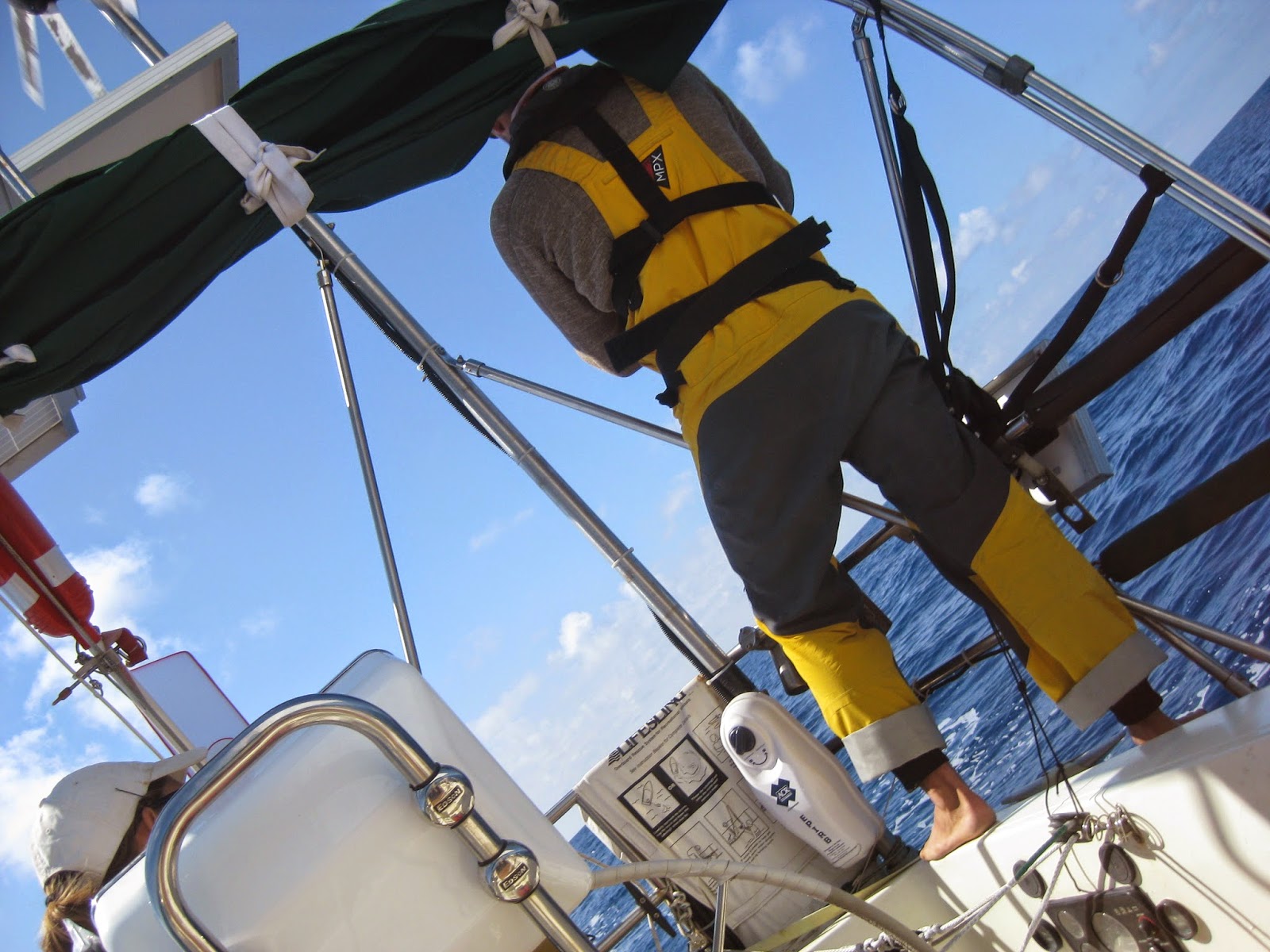
That's me in there, if you can't tell.

Adam all bundled up in his bunk.

Cold and fog!  Not very fun.

The cold was actually my greatest fear about this whole northern crossing.  I do not do well in the cold.  There were a few cold days and many colder nights but most of all I remember a fun time with smooth sailing and sunshine so I will end with a few pictures of those happier times.
Pizza and beer after our first week out.


We called them sail-jellies but apparently their real name is velella.  These small creatures littered the surface of the ocean by the millions for almost the entire trip.  Sometimes it looked as if the water had sequins!
The fin of a Pacific Sunfish as it is startled by our boat.  This was the last animal on my "must see" list of wildlife for the year.  Adam and Andrew spotted it, woke me up, and then circled around so I could get a view and some very crummy pictures.
Adams favorite sail combination: wing-on-wing with the asymmetrical spinnaker and genoa!


On the dock in Port Angeles as we say goodbye to Andrew in the wee hours of the morning.  He had to catch a bus and we had to catch the tide.
Thanks again to everyone following and commenting on the blog this year.  We have had more than 15,300 views since September!  As I said before, stay tuned.  I am still not quite sure what I am going to do with the blog, but first I am going to try and figure out how to post some of the videos we took on the crossings.

Tuesday, August 19, 2014

Sunshine in Seattle

Adam and I are still in shock.

First, we have never felt so loved in our lives!  Thank you for all of the support, phone calls, care packages, dinner parties, slip decorations and miles traveled by some of our guests over the last week to welcome us back to Seattle in style.  We are awed and humbled.

Second, we still can't believe that Adam somehow convinced me to sail through a cold northern ocean to the Pacific Northwest just at the end of summer.  His faith in me (and some warm clothing carried by my Mom when she visited us in Hawaii) gave me the courage to embark on this trip and I was literally dancing in the cockpit during the last 24 hours. There was rain pouring down, I was wearing five layers and felt like the Michelin Man every time I moved, but I was ecstatic because land was near and we were experiencing the coldest, wettest day of the trip.  I had anticipated that the entire trip would be that way but instead we saw much more sunshine than we did between Mexico and Hawaii and although it was cold at night most of the days would have been extremely pleasant it we hadn't had to motor so much.

Third...what next?  We know what happens in March: the residency match.  At that time we will find out where we will be for the next three or four years.  However, between now and then we may be a little transient.  We are living on the boat in Shilshole Marina in Ballard (part of Seattle) and will, most likely, be working at Ballard Kayak hauling boats up the beach and possibly leading kayaking tours.  Our wonderful friends John and Becca who visited us in Mexico for Christmas own this unique and expanding business located on Golden Gardens Beach, just feet from the Marina.  We will also be doing odd jobs like boat work, babysitting, dog walking, etc. to rebuild our bank accounts.  The kayaking season in Seattle ends in little over a month, right in time for residency interviews and then, very soon, the holiday season.  After such a long trip we are both very excited to see our families and will definitely be visiting Madison and Raleigh at some point in November and December.  After that I have to (get to?) go back to school.  I have three rotations before graduation in May, when the next adventure begins!  Moments may go on the market but we haven't made that decision yet.

---------

Wrap up on the trip:

We made the distance (Hanalei Bay to Neah Bay) in 24 days.  We used about 60 gallons of diesel.  The maximum winds we saw were 30kts, sustained.  The highest waves were 15ft.  The wind turbine churned out more power than we could use even when the freezer was running full blast full of fish.  And, we sailed with only a headsail most of the time; in light winds we used the asymmetrical spinnaker and in heavier winds the genoa.  The waves were at our beam almost the whole trip and the main just flopped around slowing us down.

We caught more fish than we could keep.  So many that we feel certain we could have lived on fish if we kept the poles in the whole time.  Initially it was Mahi-Mahi and then as the water got colder primarily albacore tuna.  Even me, a sushi lover, got sick of tuna.


---------

Keep an eye on the blog.

I am not sure what I am going to do with the blog.  I have really enjoyed feeling in touch with people and being able to share our experiences with those at home and the friends we have made along the way.  I plan to post some more pictures of our trip when I have enough internet to get them off of our phones and camera.  After that...who knows.  Maybe medical blogging is in my future.


Thursday, August 14, 2014

Home Again, Home Again

We have made it!  After a long night of motoring we entered the Straight of San Juan de Fuca shortly after sunrise yesterday, Wednesday, August 13.  True to Seattle form it was raining, and continued to rain most of the day despite our attempts to clean and dry out everything on the boat.  We had hamburgers for dinner in Neah Bay, yum. Still a little damp, and after a short nights rest, we are headed further down the sound today to Port Angeles where we will be saying goodbye to Andrew.  More to come on our passage as soon as we reach Seattle.

Friday, August 8, 2014

Home Stretch


Currently, I am sitting at the computer waiting for a weather fax to complete.  As I mentioned in a previous post, NOAA sends out the weather fax documents via radio transmitters all along the coast.  Right now we are receiving a signal from Honolulu which is gathered by the SSB antenna and then translated into an image by our little modem and the computer.  The winds picked up last night, as we were expecting.  It was also good that we had close to no wind for most of  yesterday, because we were able to organize, clean and prepare the boat for the weather that will, hopefully push us the 4-6 days to Cape Flattery.  On a long trip like this the inside of the cabin can get quite disorganized as people change clothing, switch shifts and live their daily lives all within the 300ish square feet of the boat.  This is typically not a problem until the weather or swell picks up and then these discarded and unsecured items go flying across the cabin and invariably land on someone's face while they are trying to sleep.

Things are going well and thanks to great sailing for the first week of the trip (we actually made over 150nm in one day!) we are still on schedule.  This particular passage is known to test sailors as even in normal years (this is an El Nino year) it is marked by feast or famine where the wind is concerned.  Looking through our position log -- where we regularly log our latitude, longitude, speed and basic weather conditions -- I can see many reports of wind around 20 kts and many where we are simply hove to or drifting because the water is glassy and their isn't a breeze in sight.  Right now there is a low pressure system over the Aleutians, headed towards the Gulf of Alaska and predicted to bring yet more strong winds as air from the high below us rushes up to fill the vacuum of the low.  As I write this we are 620nm from Cape Flattery and although, most likely, we won't be able to see it when we arrive due to fog, I cannot tell you how wonderful it will be to reach that way point.

Also, thank you to everyone who has sent us messages about the hurricanes, we know they are there and are currently more than 1000nm away from them, in very cold water, and are above the latitude reached by the northernmost tropical storm in recorded history.  Still, it feels great to know that so many people care about us and are watching our progress.  For some reason (I am blaming sunspots) we are having a difficult time connecting to send emails.  We do however continue to connect to the Pacific Seafarers Net every night and you can look at our position reports through them by changing the call sign on the tracking map from WDG8553 to KD9AFE
.

Monday, August 4, 2014

Traffic


The ocean is a big place, a very, very big place.  Although there are a lot of vessels out here at any given time, it is only slightly more likely for us to see one in our 15 mile radius of sight than it is to find the proverbial needle in a haystack.  That said, occasionally miracles do happen.  Or in our case not miracles but the intense fear of a tanker going 20 knots appearing on the horizon and headed right for our boat.  A tanker or cargo ship traveling at that speed can be right on top of us in 20-30 minutes and although they are 300 meters long their skeleton crew may not see Moments (we imagine them drinking beer and eating hamburgers in their heated pilot house).  This gets especially dicey the further north we travel because there is more rain and fog.  Without our radar system, the limited visability in rain and fog would mean very little time to react if we were to see or hear a large ship headed our way.

On our sail from Mexico, we saw three shipping vessels and two fishing boats.  All but one of the container ships was within 200 miles of the coast.  Then, one night out it the middle of the ocean, as we were changing shifts, we spotted a green light in the distance.  Sometimes we can get fooled and think that stars rising on the horizon (especially Venus) are the lights of ships, but they are rarely green.  This ship passed within 3 miles of us.  An amazing feet when you consider the vastness of the Pacific Ocean. 


This trip seemed to be similar, we passed by only one ship the first week out, but then, in the last 24 hours, we saw four container ships.  We could even see two at one time!  Most of these ships travel great circle routes, which are routes designed to travel the least amount of distance over the surface of the earth.  Because the earth is a sphere, a rhumb line on a map (straight line between two points) is actually curved and one of these great circle routes is essentially straight.  If you have ever flown on a long flight with one of those airplane trackers, you have seen this.  On a flat map Greenland seems a little out of the way but on a flight traveling a great circle route from the US to Europe you see its icy landscape out the window for much of the trip.  After so many large shipping vessels in a row we figured that we must be crossing a great circle route to some large port.  The last ship in the train looked as if it would pass within two tenths of a mile from us so we hailed the captain to make sure he knew that we were there and were hoping not to get hit or swamped by his enormous wake.


This captain might win an award for jolliest mariner and asked (in good English with a thick Russian accent) where we were headed and how long it would take us to get there.  There was a little pause and a chuckle when we told him our expected arrival time.  When we said that they should maintain course and that we would shut off our engines and wait for wind, he became concerned and asked if everything was all right on board.  We assured him that this was just the nature of sailing.  We also learned from him where all of these ships were headed: the Panama Canal.

We are now closer to Washington than we are to Hawaii and the weather is following suit.  Now it is my turn to be on watch and freeze in the fog and rain...

Less than 1000 nm to go!

Tuesday, July 29, 2014

Its getting cold out here

Things are still going well on the SV Moments.  We are dried out, aired out and still making good progress.  We were becalmed for the first time yesterday and had to motor for a while.  Now the wind has picked back up and we are again headed north.

One of the biggest challenges of this particular voyage is the weather.  Although Adam and I are far from experts, we have learned quite a bit about marine weather systems and weather predicting this year.  From Hawaii to Seattle we head through what sailors used to call the horse latitudes.  This area of relatively light winds earned its name when sailing vessels in the past got stuck here, ran out of water, and had to throw the horses overboard because they had died or in an attempt to lighten the load and sail faster.  Although we do have plenty of bacon and cold cuts aboard we decided to shy away from livestock so lightening our load is not possible unless our crew member decides he would like to go for an extended swim :) 


Unlike the sailors of yesteryear, we also have the advantage of a diesel engine which we have run for a total of 15 hours since leaving Kauai.  To put this in perspective, we only motored about 20 hours total on our way from Mexico to Hawaii; today, we have almost reached that mark and are not even 1/3 of the way to Seattle.  We have heard from a number of boats making this same trip and they have all motored more than expected.  It seems like in this year of extreme weather (remember that cold winter you had? It is all, most likely, connected) and el nino conditions the northern Pacific weather systems are not behaving as they typically do.


I have mentioned this before, but sitting in the middle of the northern Pacific, right on the rhumb line between Hawaii and Seattle, is a cold mass of air called the Great Pacific High.  The name is a little misleading because often there can be more than one high, but every year from June to September the High condenses, stabilizes, and moves south.  This enables us to get up and around it on our trip to Seattle.  Why do we have to go around it?  Well, not only is it cold inside the High, but there is no wind.  As a sailboat, no wind is a big problem.  There is no way we can carry enough fuel to motor through the High, the main body of which is well over 600 miles in diameter.  I say the main body because, surprise, surprise, this year there are multiple highs and they keep moving around! 


Using our SSB radio we download weather information at least twice a day and try to make course decisions to the best of our ability.  NOAA supplies all of this information for free and we use antiquated technology (basically a slow fax machine) to receive the charts via transmissions from Honolulu, Kodiak and Pt. Reyes.  Much to our chagrin, in the last few days a new high has formed and is moving towards us from the west as we try to avoid the even larger high to the east.  Over the next few hours/days we will be trying to thread the needle, praying that we can get north of the primary high and finally start to turn towards Seattle.  However, if we get stuck I don't think we will starve as yesterday we caught so many mahi-mahi that we ended up throwing most of them back!

Friday, July 25, 2014

Northward Bound


Although I am not typically a superstitious person, I hesitate to comment about our progress.  Each time I did so on the way across the situation would change drastically within hours!  Oh, well, here we go.


We are 430 nautical miles out of Kauai and just beginning our fourth day of sailing.  Our progress is much faster than our speed of 120nm/day from Mexico, currently averaging 150nm/day on this leg.  We are aiming for a way point at 40 degrees north, where we will finally turn east towards Seattle.  Hopefully, the North Pacific High will stay out of our way and we wont have to motor like many of the other boats we have heard from making the same journey.  We are carrying enough diesel to motor close to 100 hours, but motoring on a sailboat can be very miserable because the boat is much less stable and the engine is so loud!


During the first two days of the trip I think that everything on board got wet.  Luckily, since leaving Santa Barbara last fall, most of our electronics are stored in ziploc bags and before leaving Hawaii we wrapped up all of our books in garbage bags anticipating a wet sail.  We were drenched for a few reasons.  First of all we were beating north (sailing close to the direction the wind and waves come from) and there was a lot of salt water coming over the bow and spraying whomever was on deck.  Also, for a large portion of those first two days it was raining, a parting gift from tropical storm Wali.  We also saw some lightening, but none close enough that we could hear the thunder.  Lastly, this one our own fault, in an attempt to cool down the cabin we left a port light open and got hit with a wave just right to get, what seemed like, the maximum amount of water that could possibly fit through such a tiny opening.  Things have dried out somewhat in the last 24 hours but there is still this damp, clammy feeling about everything.  Surprisingly, the weather here is much warmer than it was on our way to Hawaii, so we haven't yet suffered being wet and cold at the same time.


In addition to sailing up wind getting us very wet, it has also resulted in more bruises than I have ever had at one time.  Andrew, our crew member, actually bounced out of his bunk and onto the cabin floor, clearing the lee cloth rigged to keep him from doing just that!  Luckily, he was not injured.  I on the other hand received the most serious injury so far when I was cooking.  I had reached over the stove to grab a plate from the cabinet and suddenly the boat moved.  The gimbaled stove, excellent for keeping food in the pot while it is cooking, tilted in such a way that the top of the hot pressure cooker caught the underside of my forearm while I was desperately trying to figure out how to stay upright.  The burn, about 3''x1'', blistered immediately and is definitely the worst one I have ever had.  Luckily, we have a very extensive first aid kit and plenty of antibiotics on board if it comes to that.  Hopefully, when we make our turn towards Seattle in a few days things will calm down again and just living will not be such a challenge.


Miles traveled: 430
Fish count: 2 (Mahi Mahi)
Days until the big right turn: Hopefully less than 5!